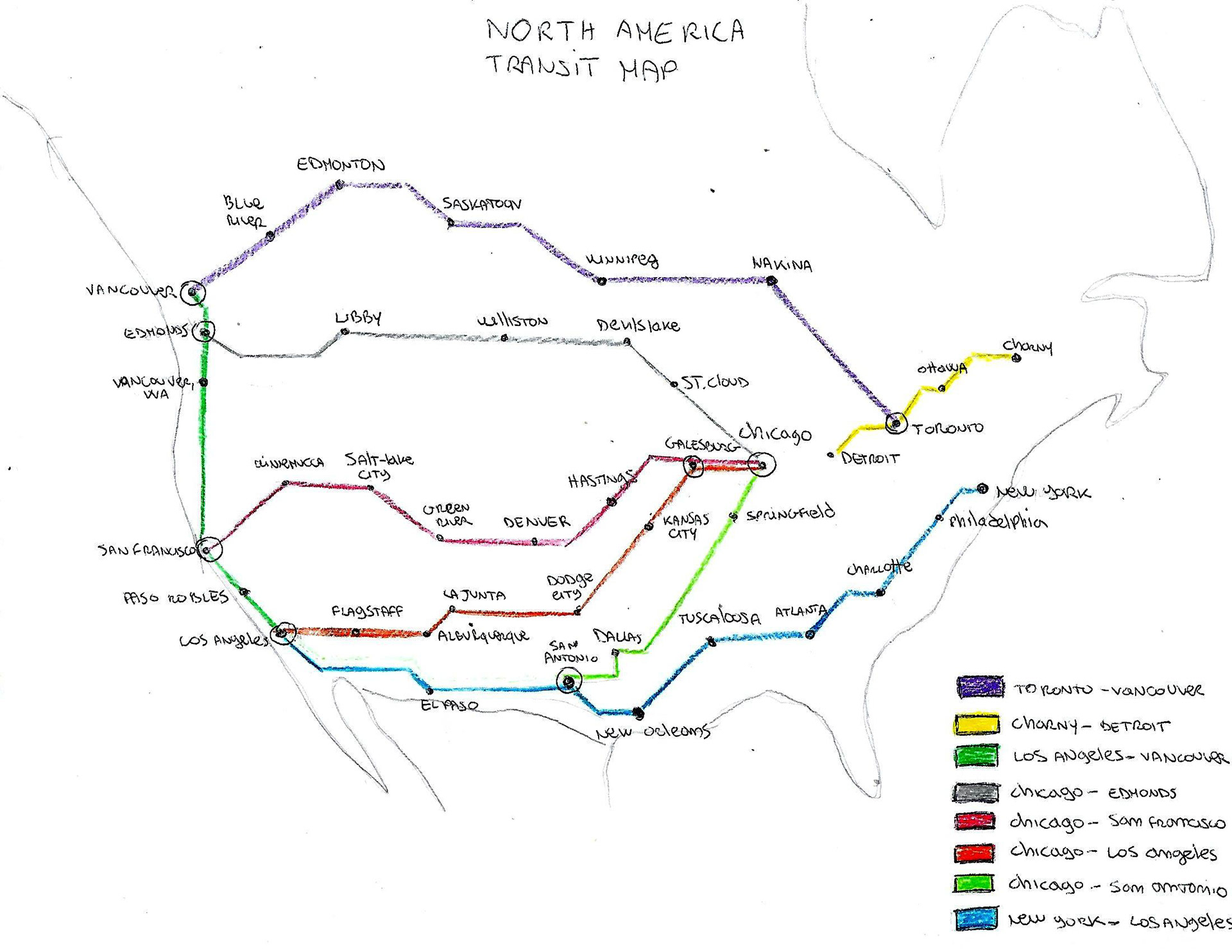
The goal of this project was to create a transit map of North America.
I researched and created a hypothetical transit map of North America incorporating a minimum of 40 stations and up to 8 interchanges. I included colour-coding for the different transit lines and appropriately named each route on a legend.